Saturday, October 10, 2009

Some dxf/dwg screens

Just some screens taken from the import of dxf and dwg files.
Note that the dwg files are badly supported, they cover < Acad2000 and I think not every case..

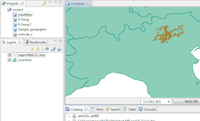
Cadastral files are one good example that here is delivered only in dxf format. Seems to work well finally:
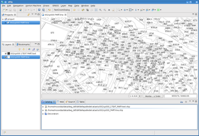
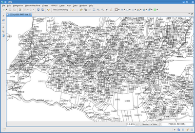


And an example of dwg, where due to the complexity of the different dwg internal types, I preferred to create 3 shapefile for evey type of data and set the layer name as an attribute, so one can select-copy/export the features to other layers.


Much has still to be tested. If you want your files tested, please send them to me, I would be glad to fix problems if I am able.
Friday, October 9, 2009

Dxf (and Dwg) in JGrass?

In our engineers job we get in tought much too often with dwg and dxf data. And much too often I told myself (and was told by my colleague Silli) that I should finally port the dxf/dwg import tool that the old JGrass borrowed from the gvSig community.

And here is finally the first step. The dxf import:

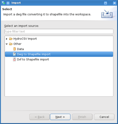
1) got to the usual import menu and find the dxf/dwg import


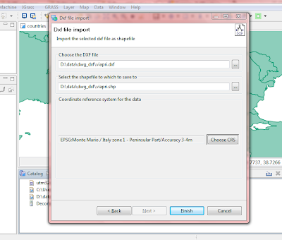
2) choose dxf import and insert the dxf file to be imported and the new shapefile to be created. Since dxf has no idea about projection, choose also a projection for the imported data.


3) push finish and wait. One layer will be created for every internal layer of the dxf file, with the data type that better suits the jts type. In this case I only had a road network:


Now have to test other types and files. Then it's dwg funtime (I hate those proprietary formats!). And then it all goes into uDig. Still have to think how though, since the license of this plugin has to stay GPL because of its prior licensing. Hmmmm....