I still remember it as if it was
yesterday. We were sitting in the lab of Unitn (the Faculty of
Evironmental Engineering of the University of Trento, where we were
doing research for professor Rigon) and we were thinking about what to
do. Money was running out in universities and the figure of external
research staff was being obsoleted. Italy was going to face one big
economical crisis.
I remember Silvia saying that she wanted to do a couple of years of research and then head off to do missionary work in Africa.
I remember Silvia saying that she wanted to do a couple of years of research and then head off to do missionary work in Africa.
I remember not knowing exactly what I wanted to do. I had just found what I loved to do: developing open source GIS. It was not just developing anything. It had to be science and it had to be open. I remember dreaming about being able to develop any kind of tool for anyone and for free... right where big big companies were charging in an unfair way. I remember thinking that research should be for everyone out there. And I remember professor Rigon being of the exact same idea.
At that time the slogan was: All in a aGIS!
We had figured that when it comes to environmental sciences, the glue to keep them all together could only be the GIS. With Riccardo we always joked about taking over ESRI at some point. Well, that one didn't work out that well. :-)
 |
| The first logo of HydroloGIS. |
 |
| The second logo of HydroloGIS. |
 |
| The current logo of HydroloGIS. |
I
told Silvia I thought she would be wasted for “normal” missionary work
and that she should push her talents hard to do what many others would
not be able to: create useful tools and then bring them developing
countries together with training for it. And somehow I convinced her on
something she didn't need to :-).
I
remember her telling me that most probably in about 5 years from that
moment she would leave HydroloGIS anyways to follow her path in
development countries.
I remember thinking: "It's ok even like that!". Being able to share a sparkling new experience with a pal that didn’t care a fig about making money exactly as I did, with the only wish to make science tools to release open source for the people… well, that was something that would not be easy to find again. We had to give it a try.
At that time she was following a master about project planning in Padova. One evening I was in the lab and she called me from Padova: “Are you serious about trying to create a company? There is this startup competition here... we could participate… everything needs to be delivered by midnight of today”. We chatted around for a short while, she gave me the link to the competition and then her cellphone battery died with her being spending the evening out (and not being easy to charge phones back then). I had no idea where to contact her again. I didn’t even know her home address at the time. I had to look up her parent’s phone in the paper phonebook (remember?) and call them to get Silvia's data for the contest. The lord meant it good to us, since during the following hours of struggle to write down the business plan idea and completing the competition bureaucracy also a name for the new company had to be chosen. Man, am I happy that HydroloGIS came that natural!
I remember thinking: "It's ok even like that!". Being able to share a sparkling new experience with a pal that didn’t care a fig about making money exactly as I did, with the only wish to make science tools to release open source for the people… well, that was something that would not be easy to find again. We had to give it a try.
At that time she was following a master about project planning in Padova. One evening I was in the lab and she called me from Padova: “Are you serious about trying to create a company? There is this startup competition here... we could participate… everything needs to be delivered by midnight of today”. We chatted around for a short while, she gave me the link to the competition and then her cellphone battery died with her being spending the evening out (and not being easy to charge phones back then). I had no idea where to contact her again. I didn’t even know her home address at the time. I had to look up her parent’s phone in the paper phonebook (remember?) and call them to get Silvia's data for the contest. The lord meant it good to us, since during the following hours of struggle to write down the business plan idea and completing the competition bureaucracy also a name for the new company had to be chosen. Man, am I happy that HydroloGIS came that natural!
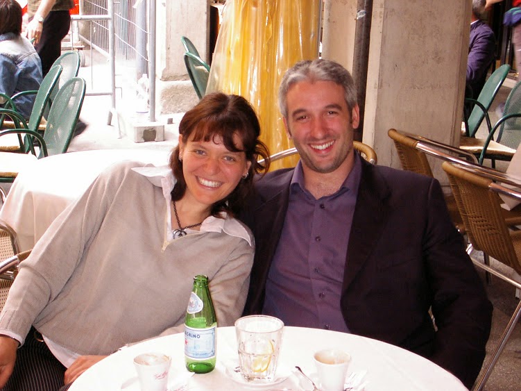 |
| HydroloGIS at "Startcup" |
Funny thing is that we wanted to try a startup competition to have confirmation about how good our idea was: Bring innovative open source technologies from the university to the professional world in order to make the world a better place. Sounds just about right, doesn't it?!?!?
Well, we didn’t even pass the first round!!! I remember project N.1 being a portable DNA analyzer device (I wonder where that company is today). We were so angry! How could they not understand!!!! So we decided to prove them wrong. And that is how HydroloGIS got born.
 |
| The really empty office of HydroloGIS at day 0. Those who now it now, would not recognize it. |
We found shelter at the TIS Innovation Park Southtirol.
At that time it was called BIC, the Business Innovation Center, which
was an incubator and highly supportive for ideas both based on
Environment and Open Source.
HydroloGIS, John Preston from the Jamaican reserach center ICENS
and the University of Trento developed together JGrass, the open source
GIS that wanted to be a userfriendly graphical interface for GRASS and
specialize on hydro-geomorphological processing based on professor
Rigon's past decade of research.
 |
| The first JGrass logo, based on GRASS' logo |
At
that time the only development sponsorship to JGrass came from the MIGG
course that we held with Rigon's team each year at the University of
Trento.

And this was the first team preparing the course right after the MIGG2005 edition:
 |
| Andrea Cozzini, Erica Ghesla, Silvano Pisoni and HydroloGIS |
 |
| Here the first JGrass versions have been developed. |
One
thing we have always been bad at was looking for work. At the very
beginning we tried some commercial campaigns to sell HydroloGIS products
around the region. Eventually we figured that it didn’t work. We have
never been able to explain what we do properly and we simply didn’t have
the skills to sell.
Luckily
for us at the start there were some rather badly paid, but extremely
interesting, projects with the university. Then later some jobs for
government agencies came in. Interesting enough, we never looked for a
job since then. The jobs just came to hunt us. And I mean it when I say
"hunt". People started to come to us when they didn’t know where to head
to solve their problems, usually after having tried for a while, hence
burning both avaliable time and budget. And we took all those jobs, once
again, bad paid and sometimes so demanding, that we had to work for
free a long time to finish the job. Those were (hard but) great times,
in which we grew incredibly from a professional point of view. But those
were also hard times. And I exactly remember getting at the end of the
year not having enough money to pay taxes. After a year spent working on
average 15 hours a day!
But still we stuck to the plan: do everything the open source. It had to work!
Eventually one year passed and we were still in business:

and not in the worst shape (even if I was gaining quite som weight, eventually passing 100Kg :-) ):

In
the years that followed (initially mainly on behalf of the University)
we taught at several different courses and master courses, gave lessons
at the university and to professionals, participated at many
Conferences, EGUs and FOSS4G's, went to code sprints, developed GIS,
made Engineering work, entered the OpenMI Steering Committee, the uDig
Steering Committee, developed and coordinated JGrass, BeeGIS, the Nettools, the JGrasstools, Geopaparazzi and eventually won different innovation competitions.
 |
| Silvia winning the first price for innovative women entrepreneur. |
 |
| GRASS code sprint in Prague. |
JGrass
went through many different periods. Being rejected from the GRASS
community we had tried to develop it on our own, but it had overwhelmed
us. we were not a pure software company.
 |
| A short history of JGrass until 2010, as presented at FOSS4G Sydney. |
So
in 2007 one big move had been done, the migration in what I was
convinced was the best java open source desktop GIS (I still am
convinced it has that potential): uDig
 |
| The first splashscreen of JGrass as uDig extension. |
 |
| HydroloGIS, beyond others, teaching to high school teachers in Cape Town after the FOSS4G. |
 |
| Talking about JGrass at Foss4G Sydney. |
 |
| and having great fun at the same conference, always wearing the colors :-) |
 |
| always ready to attend to important meetings to shout out our thoughts. |
With the begin of my PhD at the University of Urbino a new open source door opened up. The mobile field mapping.
The
BeeGIS extensions for uDig were developed in that context, which gained
quite some interest. Being uDig based it worked only on full size pcs,
or better tablets. Back then the big deal where Ultralight tablets, that
had some complete-yet-downscaled operating system and were able to give
enough juice to make uDig run on them.
 |
| The splashscreen of the BeeGIS release for which ARPA Piemonte sponsored a nice part of development both for BeeGIS and uDig. |
 |
| Digital field mapping as PhD student in Urbino. |
Today I still have to laugh about that and I know some of you don't even remember. But tablets were heavy back then:

but everything is possible if you only want it:

In 2007 the first Geopaparazzi was born. And nothing has been as it was before :-)
We
were finally able to have a tool that we would always have with us and
with that we would be able to map in extreme situations:

Android
made the BeeGIS project die out, because we simple stopped using it to
develop the Geopaparazzi project, which, funny enough, turned out to be
our most supported in the GFOSS world. There is even a facebook group for it now :-)

The
years passed and many interesting things happened, as well as quite
difficult things that hit hard on us. We tried to work tightly with
other companies, which sometimes didn't work out well. We also tried to
have employees, which did really work badly and we figured that would be
something for when we are old :-).
As
I am writing this up now, overwhelmed by happiness and proud of what we
achieved, all the bad things just vanish and I could go on telling you
stories about our life, but I think it is really enough now. :-) It is
really more material for a pub than a technical blog. But you got the point: I love the way HydroloGIS turned out, with its ups and downs.
The sole fact that few years ago I have been able to go back again to do music actively with my Alpentraum Orchestra,
is a great indicator of having achieved what I wanted to: a job I love
to work on every minute of the day and (some degree of) complete freedom
in the organisation of time, which makes family and music possible.
Over time HydroloGIS made sense, even if they told us that it would not make sense to sell things for free and that we were crazy to do that in our niche of work... well, we were never able to properly explain it around here, we simply knew it was the right way. Eventually we figured that it was the somehow old Italian method that was wrong, not us.
Over time HydroloGIS made sense, even if they told us that it would not make sense to sell things for free and that we were crazy to do that in our niche of work... well, we were never able to properly explain it around here, we simply knew it was the right way. Eventually we figured that it was the somehow old Italian method that was wrong, not us.
Our open source products and community involvement started to bring great jobs outside Italy and even overseas.
While we still were not able to get work within a 100Km radius around
our office (not one single job), we started to work in Germany, Finland,
England, the United Arab Emirates, New York.
And obviously there were the projects in development countries, so important to Silvia :-). We were able to bring training sessions and our tools to Rwanda, Ethiopia and Kongo and work on water management systems. The sparkling new agreement with the GISMAP will help us to spread Geopaparazzi in the eastern side of the globe.
And obviously there were the projects in development countries, so important to Silvia :-). We were able to bring training sessions and our tools to Rwanda, Ethiopia and Kongo and work on water management systems. The sparkling new agreement with the GISMAP will help us to spread Geopaparazzi in the eastern side of the globe.
 |
| Silvia teaching Geopaparazzi in Arba Minch. |
 |
| Teaching uDig and GIS at the University of Arba Minch. |
Alright,
I think I have kept you here for enough time now and my story is
getting very confused. I know I missed many important things and people.
Don't feel bad about it, this is a simple writedown, in a couple of
hours, while browsing through old pictures and sensations.
One
last thing I want to do is to thank those that believed in us even when
there was no money and no future (well, that would be for about the
first 6 years :-) ). Thanks to our families and partners, that supported
us by any possible means. Thanks for being there, thanks for supporting
without asking questions. Just thank you!

(In this picture, taken on HydroloGIS' 8th birthday, my mother and my sister Michela are missing. My mother was taking the picture and Michela lives too far away to be able to attend to every party we throw :-). I want them to know that they are part of it.)
Thanks
also to Silvia, with who I had the luck to share these last 10 years.
It has been sometimes difficult, she is soooooo hard-headed, but then I
know I am too. :-) Thanks for letting me try all those things, even if
no evident money would come out of it and we were starving :-) Thanks
for being the other half of HydroloGIS.
 |
| HydroloGIS is Tony and Silli. |
Last
but not least, thanks to all of you that have sympathized with our
concept of leading such a small company the meritocratic and open source
way. We know you are out there and we have always been honoured when
you told us how much you respect and like us.
Happy 10th birthday HydroloGIS, while my eyes are getting slightly wet...


