Tuesday, January 6, 2015

How to properly create spatialite data for geopaparazzi

This has been asked quite some times and too often people complain about the fact that spatialite databases created in QGIS are not visible in Geopaparazzi.

I know, I also wish it was always simple and straight forward.

What I can do right now, is to show you the procedure I follow to create vector data to work with in geopaparazzi. It uses Spatialite-GUI though, not QGIS.

1) Download the Spatialite-gui

You can find it on the spatialite homepage, at the time of writing a good version for windows is version 1.7.1 available in this download area.

Open it and find yourself with:


2) Create a new empty database in which to load the shapefile data


You will be asked to save the database somewhere on disk. Once done, you should find yourself with something like this, but with different path:


3) Load the shapefile

To do so locate the Load Shapefile icon:


In this example I will import a set of shapefiles from the Natural Earth dataset, in particular the following onces:


that can be found here.

The import dialog is the important one to fill the right way:


The really important things to take care of, are underlined in red:


  1. the SRID, i.e. the EPSG code of the data projection. If that one is not right, then you will not be able to see the data in geopaparazzi. Don't even hope in miracles!
  2. the Charset Encoding. Make sure to choose the right one. For example Japanese people might want to choose SHIFT_JIS if they want to see the labels rendered properly
  3. force the creation of the spatial index
If you then the push the ok button, you should find yourself with an ok message like this after the import:


You are almost there, one last step to go.

Right-click on the database name and select the Update Layer Statistics command.


Depending on the amount of data it should keep your harddisk working for a bit. Don't think it finished unless you see a result like the following:


Once this result appears to you, you are good to go.

Move the spatialite database to your device, fire up geopaparazzi and go directly to the spatialite data view (from the mapview).

You should see something like:


Enable the countries and places layer, maybe also activate the labels for the places layer. And voila'!


This has always worked for me. I hope it will solve any issue people might have.


Thursday, November 20, 2014

Geopaparazzi 4.0.1 is out: Welcome to Slovakia!

Geopaparazzi 4.0.1 has been released to google play.

This is mostly a language update release and includes Slovak as new supported language.

This is the current status of the localization effort:


Some languages need more love than others. Do you have that love to share?
Just jump on the geopaparazzi translation site.


We also hit the 10000 installs badge in google play. That is not so bad for an engineering app, right? :-)


Release note have changed place as well as the download area for those without access to google play. This is thanks to the fact that the amazing Github gives a clean and simple space to add releases with binary downloads.


And that's also quite all. Enjoy!

Monday, October 6, 2014

Geopaparazzi at FOSS4G 2014 Osaka/Tokyo

This year I have the great honor to be invided to attend and present a the FOSS4G in Osaka and Tokyo and do some research with the team of professor Venkatesh Raghavan.

There will be to mainstreams we will contribute to:

Geopaparazzi

http://www.geopaparazzi.eu

This is quite natural, since the Japanese is one of the most supportive communities to the project.

Well, we do not know all the details about the program yet, but we know for sure that apart of the talks there will be a:

Hands-on workshop:  27 Oct 2014: FOSS4G-Osaka

Code Sprint: 25 Oct 2014: FOSS4G-Osaka

I have to admit that for me as author of Geopaparazzi it is amazing to attend the first geopaparazzi code sprint in Osaka. I do love code sprints!

I know for many of you it is far, but maybe some nearby community members can come? It would be great to meet you in person and maybe discuss some future geopaparazzi features.


uDig, the Spatial Toolbox and LESTO

http://udig.refractions.net


We will give some presentation about uDig and its Spatial Toolbox, both from a technical point of view as well as a user pooint of view.


We will also introduce the LESTO toolbox, which enables LiDAR data processing in the Spatial Toolbox.To get an idea about LESTO, have a look here.


That is all for now. But we'll keep you posted as soon as we have news.


Monday, September 22, 2014

uDig 1.4.0 on Osgeo4W + BeeGIS and the Nettools (and java 7) + 32/64bit

I have been made aware of the fact that java is outdated on Osgeo4W and that I am the maintainer. So I checked into it and noticed that I never upgraded uDig to 1.4.0 (and of which I know I am the maintainer).


Also I was told that the Nettools didn't work very well and even BeeGIS!!!


So I took the time to do a huge upgrade of everything and and very important: also added the 64 bit versions for Osgeo4W. This is almost mandatory for those that do raster data processing with uDig.

So pick your software: 32bit installer or 64bit installer.

Enjoy!!! :-)


Tuesday, September 9, 2014

Geopaparazzi 3 retirement

Since Geopaparazzi 4 is getting near to a first release and a lot changed in the database and project formats, we think it is important to have a Geopaparazzi 3 version still out in the market for those who still need it.

Even if Geopaparazzi 4 will have a ton of new features and will be the maintained version, at least two reasons come to my mind for using Geopaparazzi 3:

  1. if you were using it with the geopap-browser, since the project structure of version 4 is no longer compatible with it
  2. if you are using it to work on OpenStreetMap POI insertion. At the moment the OSM tags part is broken in version 4.


We would love to do more, but resources are not available to maintain two versions of geopaparazzi.

So right now we fixed the last bugs reported for version 3 and created a new application named geopaparazzi3, which you can find here in the google play. (it might still take a few hours to be visible though)

This will most probably be the last bugfix release for Geopaparazzi 3.

On the bright side this definitely opens up the doors for Geopaparazzi 4, which will soon be out in the wild.

Tuesday, August 19, 2014

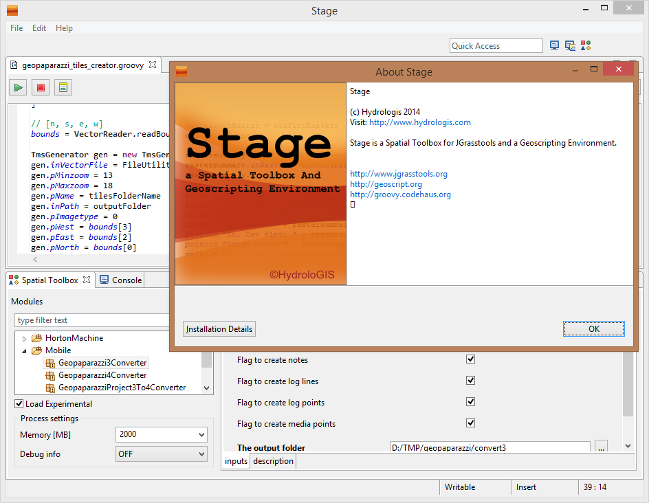
STAGE - Desktop Tools (also) for Geopaparazzi

With the new upcoming geopaparazzi 4 release a few issues had to be solved:
  1. What should I do with all my old geopaparazzi 3 surveys? How do I integrate them with new data?
  2. What do I use to export data from a geopaparazzi 4 project to my GIS environment?
Well, we solved both the above problems inside STAGE, a Spatial Toolbox And Geoscripting Ennvironment, which is the tool we develop and use for the JGrasstools library for environmental modelling.

For those asking if it is the same Spatial Toolbox that comes with uDig, the answer is yes and no. Yes, because it is the same source code. And no, because since uDig is in the process of (and a bit stuck in) migrating through the Locationtech incubation, we needed to step forward with the geotools versions. So see STAGE as the temporary solution to work with the Spatial Toolbox, until we can enhance the uDig version again.


So where do I get STAGE and how do I use it for Geopaparazzi? A video tutorial showing it all can be found here:


Enjoy!


ADDENDUM: since it has been asked, this is the link to the current download area of STAGE: http://git.io/stage_releases


Tuesday, August 12, 2014

The New York Natural Heritage Program embraces GeoPaparazzi! (a small preview of Geopaparazzi 4.0)

I am really excited to say that the Research Foundation for State University of New York really did embrace Geopaparazzi for some of their projects and sponsored a nice piece of functionality:

EDITING OF POLYGONS IN A SPATIALITE DATABASE!

This is a functionality that has been in the wishlist of many Geopaparazzi users and thanks to Tim Howard and his group, it is going to happen really soon.

I also hope to get them to write us a nice post about their use of Geopaparazzi in the field of mapping invasive species.

Since these new functionalities were calling for a geopaparazzi 4.0 release, it was about time to also do one other long wished (at least by me) change: make the Geopaparazzi project single file based, in order to be self-contained and compact.

I won't keep this post really long right now, it is more about letting you know what we are up to next and also thank the Foundation for State University of New York for the sponsorship.

To explain a bit the two main changes that will be in Geopaparazzi 4, a small preview of it in two quick and simple videos.

The first one focuses on the new project structure, which has changed from a folder structure to a single sqlite file:


The second one shows how to use the spatialite polygon creation and editing tools:


We are currently in testing phase and some small things may change, but this is more or less what it will look like.

Geopaparazzi 4 is going to be exciting, I am looking forward to it!
Enjoy!!


PS: There are two major downsides to this migration:
  • we will need a conversion tool to transform old Geopaparazzi projects into the new, single file based, project format. I have a huge archive of hiking and travelling projects I can't loose... they are kind of my diary.
  • the OSM tools were currently lost in the process, since the database notes structure has changed
We are currently out of resources to solve this right away, but we will do our best.