We are finally starting to expand a bit the console scripting language.
What does that mean?
Well, that to get a martix of data from a map you now can write:
def matrix = fromMap("mapname")
and then access as an array the matrix.
The same works the way round:
toMap "mapName", matrix
Note that if the method returns a value, you need the brackets around the parameters.
What else?
You can now load a raster to be visible like that:
load "mapname"
And how many times did you want to isolate some maps from a mapset full of maps, to give just those to a collaborator?
Now you do it like that:
copyToNewMapset "test", "adigeall_dtm", "adigeall_pit", "adigeall_flow"
which will create a new mapset (in this case named test) inside the current location and copy there just the maps you want (which in this case are 3).
Delete maps?
deleteMaps "adigeall_dtm", "adigeall_pit"
And more will come when it is needed. If you have cool ideas please let me know here, in the jGrass list or even better open a bug request for new feature.
Sunday, December 28, 2008


A merry Xmas and a happy new year...
A bit late for the fist, a bit early for the second... anyway...
from the HydroloGIS-JGrass team
from the HydroloGIS-JGrass team

Wednesday, December 17, 2008
Monday, December 8, 2008
Enhancements in the annotation layer
The time has come to enhance the annotation tool of beegis.
We now have two tools, one to create and one to destroy:
 1) the annotation tool has been enhanced for tablet pen usage.
The width and transparency are no longer sliders, but predefined combos. Less freedom sometimes can lead to better productivity. :)


The properties panel gives the possibility to quickly remove the last inserted stroke, without the need to change the tool.
Anyway, sometimes one needs to remove a stroke inserted earlier, so the need for an annotation remove tool grew.
2) the annotation remove tool
Since we are sopposing to be on the field with a table and it is not easy to pick exactly the stroke we want to remove, the annotation remove tool is a line tool.
That means that you just drag to draw a line (the remove tool draws a red line) and all the intersacting annotations will be removed:

in this case the line is going to remove the M and the upper orange line.

Indeed! :)
Sunday, December 7, 2008
Ladies & gentlemen... the fieldbook
It's been a long while. Yes, not always easy to have something decent to say :)
Finally a new one: the fieldbook.
When we designed and developed the geonotes for the Beegis extentions, the major problem was to be able to organise them properly, access them quickly and save them somehow. This is how the fieldbook came to life.
The field book wants to be an easy accessible collection of the geonotes we have created on our project.
So how does the fieldbook look like?
Here you are:
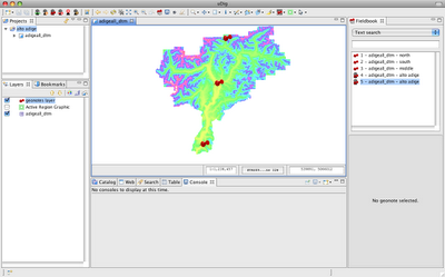
And what can you do with it?
Well, assuming a case in which we have the following notes:
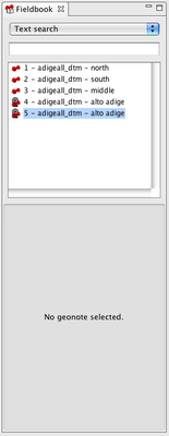
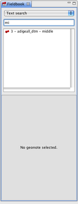
1) search by text in the title
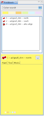
2) search by color
3) search by creation date
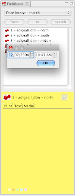
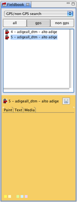
4) view gps taken notes
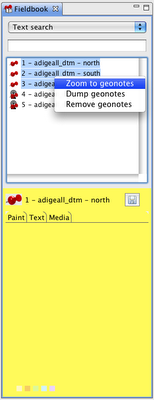
5) zoom to notes
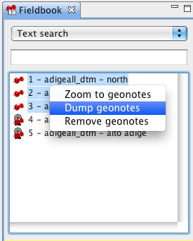
6) dump notes to disk, in which case a folder structure will be created with:
How does selection work?
1) selection from the map with the geonotes selection tool
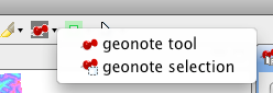 If you select by box from the map, in the filedbook only the selected notes are visible in the list.
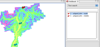
2) if instead you select from the fieldbook, the pins of the selected notes are highlighted (probably a yellow would be better for highlighted pins :)).
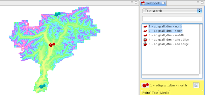
Well, that's all for now... just have to thank the ARPA Piemonte for founding this work and make it available for everyone, that is the way to behave!
Finally a new one: the fieldbook.
When we designed and developed the geonotes for the Beegis extentions, the major problem was to be able to organise them properly, access them quickly and save them somehow. This is how the fieldbook came to life.
The field book wants to be an easy accessible collection of the geonotes we have created on our project.
So how does the fieldbook look like?
Here you are:

And what can you do with it?
Well, assuming a case in which we have the following notes:

1) search by text in the title

2) search by color

3) search by creation date

4) view gps taken notes

5) zoom to notes

6) dump notes to disk, in which case a folder structure will be created with:
- an image of the paint tab
- a text file with the text tab content
- a folder with all the media present in the media tab

How does selection work?
1) selection from the map with the geonotes selection tool
 If you select by box from the map, in the filedbook only the selected notes are visible in the list.
2) if instead you select from the fieldbook, the pins of the selected notes are highlighted (probably a yellow would be better for highlighted pins :)).

Well, that's all for now... just have to thank the ARPA Piemonte for founding this work and make it available for everyone, that is the way to behave!
Tuesday, October 21, 2008
The day GRASS maps learned to fly through my projections
On of the things I was dreaming from bringing the GRASS raster format to geotools, was the fact to be able to reproject them on the fly. Be able to reproject them without all this issues around r.proj that I used so many time. Just select a box with the coordinate reference system and voila', distorce my map around the world... and now it is there, growing to be in the JGrass development version... and you have to see this...
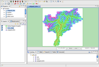
1) the adige basin in EPSG:32632, UTM zone 32N
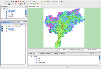
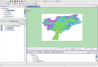
2) EPSG:3003, Gauss boaga (no evident change, just coordinates change)
3) the almighty EPSG:4326... the World Geodetic System 1984...
Tonight I will sleep quite :)
And soon the export to reprojected geotiff will come...
As good Simone makes me notice, I should thank those guys that helped me with that odd thing that is coverage. Some knowledge came from both (in alphabetic order :)) from:
1) the adige basin in EPSG:32632, UTM zone 32N

2) EPSG:3003, Gauss boaga (no evident change, just coordinates change)

3) the almighty EPSG:4326... the World Geodetic System 1984...

Tonight I will sleep quite :)
And soon the export to reprojected geotiff will come...
As good Simone makes me notice, I should thank those guys that helped me with that odd thing that is coverage. Some knowledge came from both (in alphabetic order :)) from:
Monday, October 13, 2008
How to get GRASS related preferences into your code
What to do when you need the mapset that is currently set for doing calculations or even the path to the GRASS GISBASE?
Go and buy some at your preferred store:
Go and buy some at your preferred store:
           ScopedPreferenceStore preferences = (ScopedPreferenceStore) ConsoleEditorPlugin
                   .getDefault().getPreferenceStore();

           String mapsetString = preferences.getString(PreferencesInitializer.CONSOLE_ARGV_MAPSET);

           String gisbaseString = preferences
                   .getString(PreferencesInitializer.CONSOLE_ARGV_GISBASE);
Subscribe to:
Posts (Atom)