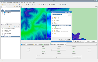
Window -> Show View -> Other
Which wil then open something like the below and from which you will choose the raster query tool:

The tool will open a view as you can see it in the first picture on the lower part, inside of which you can choose a map to query. Click on the button, choose your map and if you move over the map, in the view the central point, the 8 pixels sourounding it and the relative world coordinates are shown.
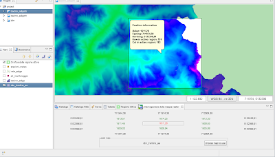
Sometimes this however gives a feeling like watching a movie with subtitles, you are never able to concentrate on the movie. That is why you can also click on the map, which will open a nice Balloonwindow (thanks to http://www.novocode.com/swt/) with the needed info in it:

The best part of it?
Go into a text editor and paste... huuuuu... :)
No comments:
Post a Comment