You want to create a shapefile out of it.
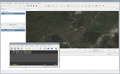
step 1: create a simple CSV file with the coords to add an attribute:
11.33260, 44.16922,test1
11.34121,44.17156,test2

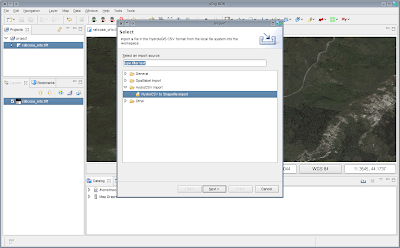
step 2: go under the file menu and select import

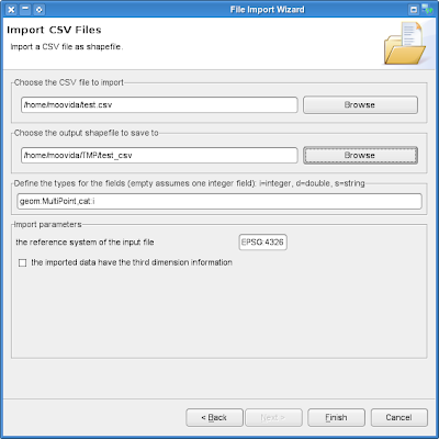
step 3: fill in the wizard parameters
- the csv file to convert
- the output shapefile
- the description of the shapefile. The first is the geometry, which can be of 2 coordinates or 3 (need to check the box for that). Then every other attribute needs to have exactly one equivalent in the csv file
- the coordinate reference system

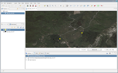
step 4: press finish and drag the new created shape in the map

No comments:
Post a Comment