SMASH now supports loading of raster imagery in the tiff/jpg/png + worldfile (tfw/jgw/pgw) + projection file.
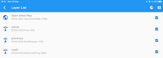
So once you load the rasters in the layer view, it will check the projection.
So once you load the rasters in the layer view, it will check the projection.
In this case we have 3 different projections and while 4326 and 3857 are supported. So the first time this happens you will need to tap on the layer to try to download the proj definition for the projection.
The result is quite nice and transparency can be applied where needed.
Here below a jpg loaded in 32632:
and a tiff loaded in 3857:
Small confession: this is the reason there has been also a version 1.1.0. We found out there were some issues with the projection of the raster imagery files and decided to fix them an release right away.
They are and will always be (unless someone pays tons of money) read-only layers. All the editing will be moved to geopackage in future.
TMS has already been supported, now WMS is also here. And there is a beautiful catalog to hold them:
The maps are actually live maps which help to see if a service works even before adding it.
WMS looks the same and both can export and import the definitions:
To add a new definition, since that is a rude thing to do on the device, we tried to make it as comfortable as possible:
Layer management
Layers can now be dragged to reorder them and they can be removed with a right-to-left swipe.If they support zooming to or styling, it is found in a right-to-left swipe.
Note that this is now harmonized in all list views with zoom and style.
Notes:
and logs:
GPS
The biggest new is for sure the fact that SMASH now supports background logging, i.e. logging with the screen off. No image here, but you know what that means.
We also added to the settings view:
a GPS live view to be able to play with the settings and see what happens:
As you can see the rose of incoming points is visible in the background, so give an idea of what is going on.
Last but not least, it is possible to activate a counter for GPS points (all vs filtered) to be seen on the main view in the GPS icon:
Other notable things
Debug view
We added a debug view, accessible from the settings:And an online help has been added, which is never bad :-)
We added labels also to project notes:
Grid
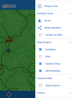
A nice grid plugin has been added to flutter map, so we added it here also:Reprojection support
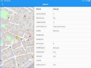
As mentioned in the raster imagery part, support has been added for projections. If a projection is not known, it will be required to download its definition. After that vector data will be reprojected properly. This part is still a bit experimental. But it already looks good.
Small things
- sharing the position has now the Openstreetmap url
- fixes have been done in the forms engine
Guess that is all! Enjoy!


1 comment:
Thank you, this blog is awesome and super. I really love your article. Thanks once again,
Switzerland VPS Hosting
Post a Comment