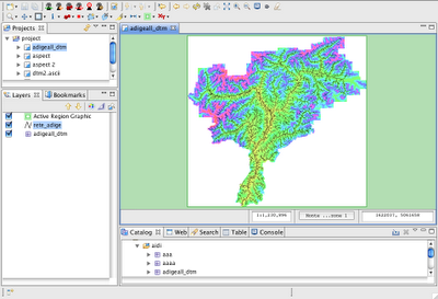
1) the adige basin in EPSG:32632, UTM zone 32N

2) EPSG:3003, Gauss boaga (no evident change, just coordinates change)

3) the almighty EPSG:4326... the World Geodetic System 1984...

Tonight I will sleep quite :)
And soon the export to reprojected geotiff will come...
As good Simone makes me notice, I should thank those guys that helped me with that odd thing that is coverage. Some knowledge came from both (in alphabetic order :)) from:
2 comments:
Man what about adding a "many many thanks to the GeoSolutions guys for providing tech tips along the line"?
:-)
Great stuff!!!
Ya man! You are right :) Here you are!
Post a Comment