Thursday, August 20, 2020

SMASH 1.4.0 is out: SLD and GPS Log enhancements

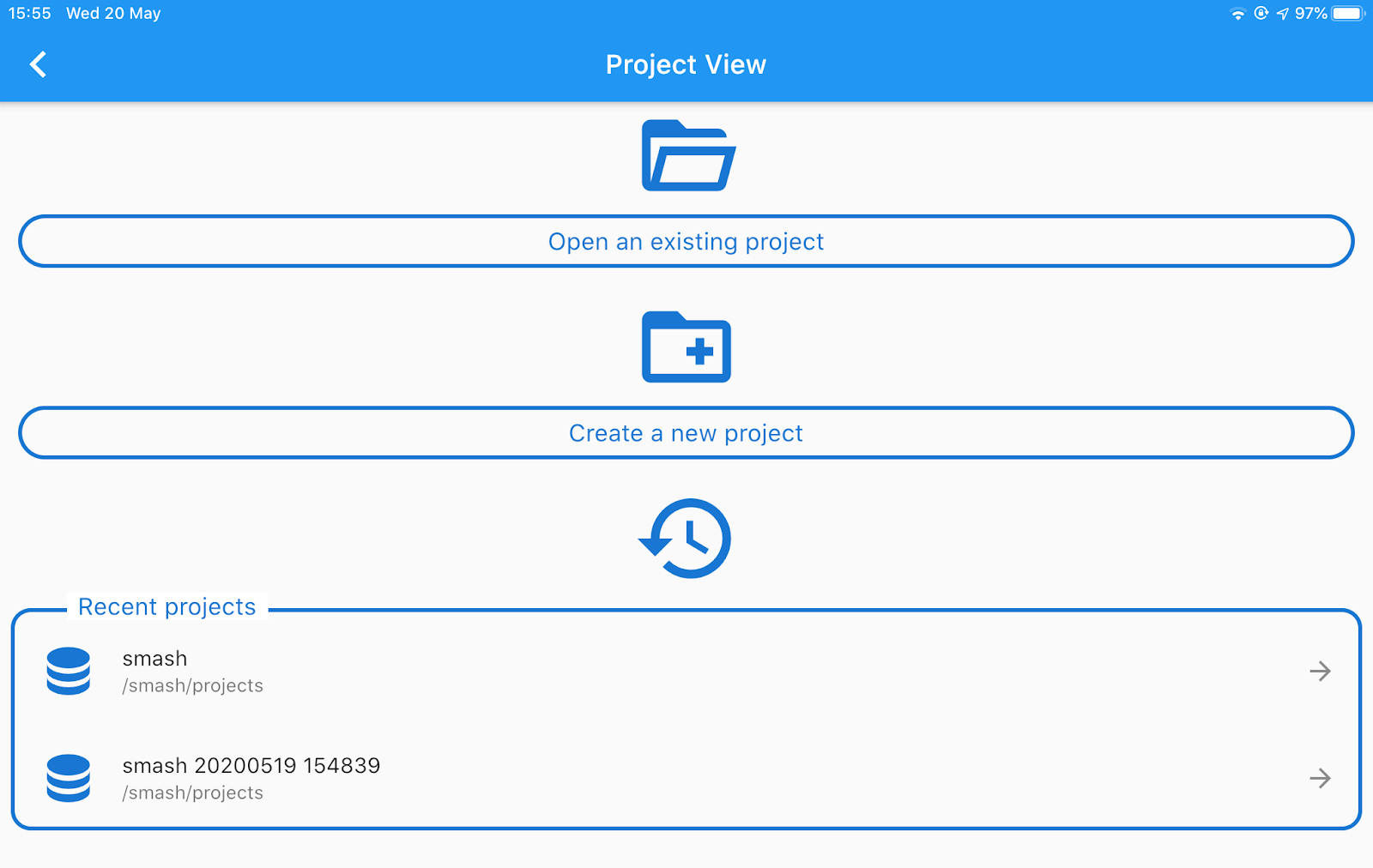
Today we released SMASH 1.4.0 to the Apple and Google stores.

This release brings some bugfixes and two main features.

1) SLD support

When it comes to styling data many have expressed their hate towards the OGC standard SLD. Coming from the uDig/Geotools world, where SLD has always been used, I find it quite nice to use. Well,  I use it for very simple styling, so that might be the reason behind it. Well, it seemed to be the perfect format. There are several editors and GIS that support SLD, so people will be able to create their styles for the survey. And now SMASH is one of them, even if it right now supports a subset of SLD features.

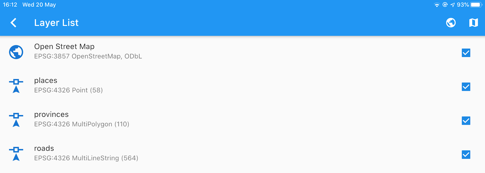
Lets' have a look. Assume to be in the region of the Resia Lake in northern Italy:

Now let's play around with some geopackage data: lake polygons, river lines and geoname points.

Sliding the polygon layer to the right allows to enter the style properties:

It is rather intuitive what needs to be done to have a lake styled. But remember to save using the floating action bottom at the bottom. This will write the style to the database table.

Et voila'. The same goes for lines:

and points. Points are the only layer types that allow labeling at the moment.

These have been very very simple styles. For those that talk SLD, these examples only had a FeatureTypeStyle and one Rule. 

SMASH supports one type of theming: by unique values. In this case a FeatureTypeStyle is populated with several rules that obey to a filter that supports matching of unique values from the attributes table.

The properties page has buttons to change rules and modify them. The following is an example that features 2 FeatureTypeStyles, one with just a Rule containing a textsymbolizer:

 
and a second one with all the Rules with filter:
 

If only one FeatureTypeStyle or Rule are present, the header titles can vary:

The result then looks like:

We decided to give also GPX files these kind of powers. If you change the style properties of a GPX layer, an SLD sidecar file is created and ensures style persistence. 

Style can be defined for lines and points. If waypoints have the name tag, it can be used for labeling.


 2) GPS log enhancements

The log stats have been extended and now contain time, length, up and down delta (mind this is GPS elevation, so it is usually bad), number of points contained in the log.

In the previous version of SMASH a Kalman filter had been added to filter GPS logs and both log types are kept in the database. It is now possible to decide to use the filtered logs in certain sections of SMASH as for example in the logs list. Just enter the GPS settings and enable the option:

If you head back to the logs list, the stats length value might be changed:

In this case the difference is around 8Km. This is due to the fact that in tunnels the GPS often goes crazy and jumps around, generating additional distance to the log. The filtered version is more realistic. But you can choose based on your usecase.


From the log list a new tool is available when sliding to the right: the Profile View

The profile view allows to analyze the profile and navigate it:

Thanks for the OwnWeb guys for this nice plugin.


Well, that is it for SMASH 1.4.0. Enjoy!


Tuesday, July 21, 2020

SMASH 1.3.0 and GSS 3.0.0 are out, in sync

Since the last SMASH release we have been mostly concentrating on enhancing the server side to have a better synchronization experience.

That said (and discussed below), some enhancements have come to SMASH:

Kalman filter for GPS logs

GPS logs are now created using both the original GPS coordinates and filtered coordinates (in this case a Kalman filter). It is possible to select what to view by double tapping on the log icon:


One can view the filtered data while hiding the original GPS data:


or view the original and hide the filtered:


or, as I prefer it, have the original in transparency and see the filtered:


which helps me to understand how bad my GPS performs in tunnels :-)

geopackage enhancements

Editing of the attributes table is now possible if the data table has a primary key. If a table is editable, the editing icon is visible:

Now let's wait for geometry editing ;-)

Visibility settings

We already have seen how gps logs visibility settings can be changed. In general we now have on the actions buttons that support it, the following paradigm:
  • single tap: add new
  • double tap: settings
  • long tap: view list
As such, double tapping on the notes button, opens a view mode dialog, which allows to configure if the use wants to see the notes with or without label, or hide them at all:


Other icons that support double tap:

  • the GPS icon: toggles automatic centering on GPS.
  • the layers icon: opens the plugin dialog to enable or disable plugins:


This is all too difficult to remember? Well, you are lucky! We just added coach markers!

Coach markers

Coach markers help the user on screen as a user manual would do. The first time SMASH is launched they are run, but they can be accessed from the upper right question mark icon:

et voila', easy to know what the actions do.

The Geopaparazzi Survey Server

So what is new with the GSS? Well, for one thing, it has been reviewed and has a more straightforward user interface:


But how does sync work in 3 screenshots?

On SMASH you take a form based note:

Assuming you set the right server in the settings, you then export to GSS. You will get a summary of what will be uploaded:


If you choose to upload, each item will start in direction server:


And on the server it will be visible the same way it was on smash, with the same icon, the same label:


The manuals!!

Would you believe it? We updated the manuals!!!

So, to see all the features for the GSS just run here: https://www.geopaparazzi.org/gss/

to see everything about SMASH, here: https://www.geopaparazzi.org/smash/


Well, that's all folks, enjoy! We have a timeline for smash 1.4.0, 1.5.0 and 1.6.0 with some features, so expect some updates during the coming year.


INSTALL

SMASH is already on Google Play and will be on the Apple store in the next hours.

The GSS is available as docker image. The above link has installation instructions to install it using postgis.


Thursday, May 21, 2020

SMASH 1.2.0 is out... and it is packed with goodies!

SMASH 1.2.0 is out in the google and apple stores and it comes packed with a whole set of new features. Not even sure where to start. Here we go...

Welcome and Project View

We never had it, but it was time.When SMASH starts up it need to check some permissions, layers, data, forms and much more. Now you will be notified and see something is going on:


After that the projects view comes. Make your choice, new/old or fast choice between recent?


Data formats

Some new formats are available now.

Raster files in World image format

SMASH now supports loading of raster imagery in the tiff/jpg/png + worldfile (tfw/jgw/pgw) + projection file.

So once you load the rasters in the layer view, it will check the projection.

In this case we have 3 different projections and while 4326 and 3857 are supported. So the first time this happens you will need to tap on the layer to try to download the proj definition for the projection.
If you are lucky enough, the epsg was recognized and the definition downloaded. Now the dataset is loaded. Mind that while on vector data a re-projection is really performed, in case of raster images, the images is just warped using the boundaries. So this could lead to some unwanted distortions. So always bet to use 4326 data for rasters.
The result is quite nice and transparency can be applied where needed.
Here below a jpg loaded in 32632:


 and a tiff loaded in 3857:


Small confession: this is the reason there has been also a version 1.1.0. We found out there were some issues with the projection of the raster imagery files and decided to fix them an release right away.

Shapefile read support

SMASH now supports shapefiles ( outch, who would want them?). 


And they are actually styled with SLD:


And can be queried:


They are and will always be (unless someone pays tons of money) read-only layers. All the editing will be moved to geopackage in future.

WMS/TMS support

TMS has already been supported, now WMS is also here. And there is a beautiful catalog to hold them:


The maps are actually live maps which help to see if a service works even before adding it.

WMS looks the same and both can export and import the definitions:


To add a new definition, since that is a rude thing to do on the device, we tried to make it as comfortable as possible:


Layer management

Layers can now be dragged to reorder them and they can be removed with a right-to-left swipe.
If they support zooming to or styling, it is found in a right-to-left swipe.


Note that this is now harmonized in all list views with zoom and style.

Notes:


and logs:


GPS 

The biggest new is for sure the fact that SMASH now supports background logging, i.e. logging with the screen off. No image here, but you know what that means.

We also added to the settings view:


a GPS live view to be able to play with the settings and see what happens:


As you can see the rose of incoming points is visible in the background, so give an idea of what is going on.


Last but not least, it is possible to activate a counter for GPS points (all vs filtered) to be seen on the main view in the GPS icon:


Other notable things

Debug view

We added a debug view, accessible from the settings:


Better drawers layout

The left and right drawer and the actionbar have been reviewed.
The right drawer is now accessible by icon and contains all the tools, in expandable sumenus.


 As a result the left drawer is now more clean and project related:


And an online help has been added, which is never bad :-)

The GPS info panel has been cleaned up a bit and one can copy each coordinate to the clipboard:


 Notes have labels

We added labels also to project notes:


Grid 

A nice grid plugin has been added to flutter map, so we added it here also:


 Reprojection support

As mentioned in the raster imagery part, support has been added for projections. If a projection is not known, it will be required to download its definition. After that vector data will be reprojected properly. This part is still a bit experimental. But it already looks good.


Small things

  • sharing the position has now the Openstreetmap url
  • fixes have been done in the forms engine

 Guess that is all! Enjoy!

PS: as usual the user manual is lagging behind a version. Is there some gentle soul out there that would be willing to help?