Let's have a look at it wearing the JGrass gui.
First search the tool in the raster tools:

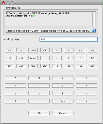
Selecting the tool you will get the calculator window:

As you can see, there is an area into which to put the equation you want to do on the maps. The equation supports a minimal syntax highlighting. Important is the fact that existing maps are written in bold and italics, so if they are not, probably you are making a typo error and you can check the name of the map before executing it.
Also there is a resulting map text field, which represents the name of the created map.
Another nice thing is the combobox that keeps track of the launched commands, also throught the JGrass session. The last 20 entries are saved over time:

In the first dialog the equation is the following:
if(bacino_chiese_pit <>2500, bacino_chiese_pit , null())
which translated means:
In the pixels of the map, in which the value is <> 2500 put the original value of the map, else put a novalue.
This is a very simple example, this tools can be really exploited with nested commands and strange stuff.
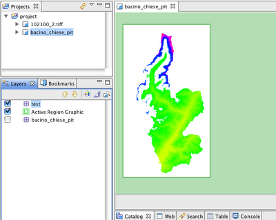
And the result is as expected:

Enjoy!
No comments:
Post a Comment