Well, since they really where that nice, we created a small import tool for BeeGIS.
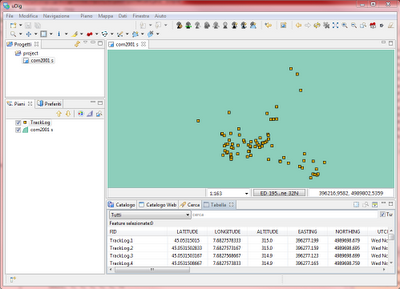
You should know that from arcpad you can export a point shapefile, which has a big attribute table with all the infos in it.
The below is an example:

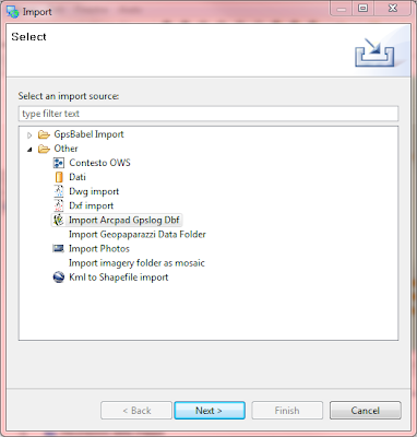
To use it just follow the steps:
1) Go to File -> import and select "Import Arcpad..."

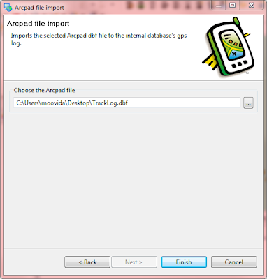
2) In the following tab insert the path to the dbf file exported from Arcpad

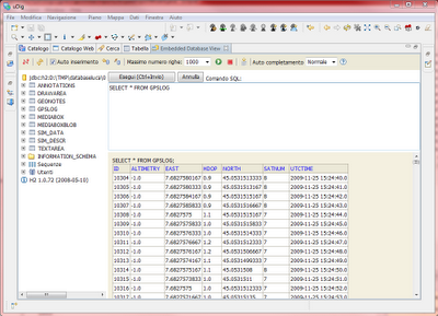
After pushing finish the dbf is imported into the database's internal gps log, which is also use for the photo sync.
In fact if we have a look into the database view, we can see that the imported data are there:

Guess that will make it into the next build.
No comments:
Post a Comment